WEATHER FORECASTS
National Institute of Meteorology and Hydrology


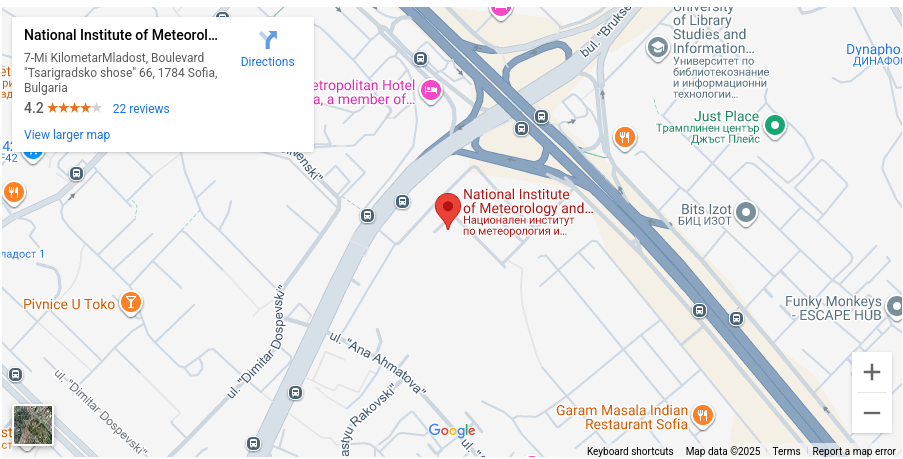
See the map on Google Maps (in a new window)
Phone "Forecasts": (+359) 2 974 44 09, (+359) 884 40 86 70
Phone "Info Center": (+359) 2 462-4610, (+359) 887 507 404
E-mail "Info Center": market@***
Fax: (+359) 2 988 0380, (+359) 988 4494
Address: Tsarigradsko Shosse Blvd. 66, Sofia 1784, BULGARIA
All e-mail addresses of NIMH are in domain meteo.bg, that is the sender finishes the address by adding '@meteo.bg'
Some of Our Products
Operational Weather Forecasts Section
A wide range of products related to weather forecast presentation: texts, graphic materials suitable for visualization through various media, prepared in raster (JPG, GIF, PNG) or vector (PDF, SVG) format.
Info Center
- Specialized forecasts for intense precipitation, comfort index/feeling temperature, fire danger, etc.;
- Expert assessments of sea state, detailed wind and swell forecasts;
- forecasts of the spread of oil spills in the Black Sea;
- information on thunderstorm activity on the territory of Bulgaria;
- average fields of temperature, precipitation, etc. for a certain elapsed period; snow cover map;
- reference to temperature, wind, rainfall, hail (and similar references) at a given point or area; the documents serve before government and judicial authorities or insurance companies;
- meteorological references for the needs of construction or other business activities.
- A sample report we issue in response to your request
In order to obtain the reference you need, you must submit request (pdf 78kb) in the office of the institute in which you describe exactly what you want.
If necessary, a contract will be signed to provide access to the information..
All e-mail addresses of NIMH are in domain meteo.bg, that is the sender finishes the address by adding '@meteo.bg'
More about Our Forecasts
Short Range Forecasts
The operational unit at NIMH issues short-term weather forecasts - daily for the next 24-72 hours. The materials used in producing these forecasts are diagnostic and predictive
The analysis (diagnosis) of the synoptic situation is carried out on the basis of data from ground and remote meteorological observations:
- 24-hour synoptic observations every three hours, which are plotted on synoptic maps of Europe and the Balkans, analyzed by a synoptic analyst - frontal systems passing over Europe are placed;
- A diverse set of up-to-date satellite measurements received at NIMH every 5 minutes from the European Organisation for Meteorological Satellites EUMETSAT, of which Bulgaria has been a member since 2005. The Bulgarian budget pays a membership fee for participation in EUMETSAT activities and NIMH has full access to the satellite information;
- available information from weather radars.
After analyzing the specific synoptic situation, the forecaster summarizes the specialized information from numerical weather forecast models. The models used in operational practice are global (with a larger spatial grid step) and local (with a denser spatial grid describing more fully the diverse underlying surface of our country). The main forecasting tool for short-term forecasts (up to 72 hours) is the ALADIN regional forecast model
The NIMH specialists, using their experience, come to an expert solution for the development of atmospheric processes over Europe, the Balkan Peninsula and our country in particular. An author's text is prepared, with specific terminology, which is also used in everyday practice, and is sent to users and published on the NIMH web-page, in order to use it for non-commercial activities. Visual materials on the expected weather development are also produced, containing minimum and maximum temperatures and the symbols for the weather type in specific points of Bulgaria, the Balkan Peninsula and Europe.
Hazardous and particularly hazardous weather warnings are also issued as part of the short-term forecast. This is an interactive map on which the areas in which the hazardous phenomena are expected are marked, colour-coded according to the danger they represent, and given a brief description. A very important element in issuing these forecasts is the availability in the NIMH of the French SYNERGIE system. This allows the ever-increasing amount of information to be combined in the forecasting process and for important aspects of synoptic information to be focused on in order to make full use of it in expert decision-making.
Medium Range (4-10 Days)
The Operations Unit in the Weather Forecasting Section prepares and issues general medium-term forecasts on a daily basis - up to a week ahead, and a 15-day forecast is issued around the middle of each calendar month.
Forecasts are based on numerical models. The main model used in the NIMH for the weather forecasts from the fourth day onwards is that of the ECMWF (European Centre for Medium-Range Forecasts, located in Reading, UK, of which Bulgaria is an associate member). The so-called deterministic model is:
- A global model;
- Horizontal resolution of 16 km temperate latitudes;
- Twice daily — at 00 and 12 UTC — it gives a 10-day forecast.
The so-called control forecast is of lower resolution. The ensemble forecast system has lower resolution and gives a probabilistic interpretation of the forecast in two time bins 1-10 days and 11-15 days. Each of the forecast systems is fed with information from four-dimensional (space-time) data assimilation schemes including both conventional meteorological information and data from satellites, buoys, aircraft, etc. The output of the entire forecast system is processed to produce a large set of products that allow general and specialized forecasts to be made for different points and regions. The ECMWF products are of very high quality. They are not generally available in the free Internet space. A membership fee is paid from the budget to participate in the activities of the ECMWF and the NIMH has access to all of the centre's output, as well as the opportunity to participate in collaborative projects and in the development of new material. The operational unit specialists in the Weather Forecasting Section are trained in the use and interpretation of all products, and continue to be trained periodically to make full use of all the improvements and innovations being made in the ECMWF.
Typically, a general medium-range forecast is formulated as a text with categorical statements, which, however, reflect the most likely weather development. Ensemble forecasts make it possible to obtain not only the most likely, but also the various possible weather scenarios, and to estimate the probability for each of them, and hence the probability that one or another event will occur. Some of the products are probabilities of rainfall above 20 mm or wind speeds above 15 m/s and can be used as a basis for specialised forecasts after the fourth day.
The medium-range forecast can also be presented (or the text supplemented) with graphical products:
- A map with expected average (for the period) temperatures and precipitation in different regions of Bulgaria - the predicted average temperatures in the numerator and the total amount of precipitation in the denominator in different cities and regions of Bulgaria are indicated;
- A diagram of the predicted weather during the period - includes a temperature curve representing the expected temperature during the period and the prevailing weather type (sunny, rainy, variable, etc.), indicated by symbols.
Monthly Forecasts
Monthly forecasts are weather outlooks for Bulgaria over the next month. These forecasts give only a general idea of the weather due to the impossibility of forecasting the details in a specific area for such a long period of time.
How Are they Prepared? The primary means of issuing monthly weather forecasts are numerical models that provide information about the likely state and dynamics of atmospheric and ocean circulation over the next month. The statistical relationships that exist between atmospheric circulation anomalies and temperature and precipitation anomalies in Bulgaria are also used.
Structure of the Monthly Forecast. Every monthly forecast comprises from the following elements:
- climatic reference for the month - contains the main features of the respective month, the norms that represent the multi-year average monthly temperatures and rainfall amounts for Bulgaria;
- outlooks for the month as a whole - the deviations of average monthly temperatures and precipitation from normal are given in the following gradations: (1) below normal, (2) around and below normal, (3) around normal, (4) around and above normal, (5) above normal, the expected highest and lowest temperatures and the time of occurrence of some special events: first and last frosts, first snow cover, etc. are also given;
- expectations for the development of the weather by ten days - the course of temperature and precipitation and their deviations from the respective norms are forecasted in the same gradations as for the whole month, expected anomalies and characteristic phenomena are described: cold and warm waves, dry and wet periods;
- map with expected average monthly temperatures and precipitation in different regions of Bulgaria - the predicted average monthly temperatures in the numerator and the total amount of precipitation in the denominator in different cities and regions of Bulgaria.
Typically, the forecast is presented as a text with definite statements that reflect the most likely development of the weather, and the uncertainty is formulated verbally. However, the use of mathematical forecasting models allows the probability of an event occurring to be estimated and, if desired by the user, can be given a numerical value. For example, "the probability of extremely dry/wet weather is 70%".
Terms: Monthly forecasts are made for each month at the end of the previous month - between the 25th and the end of the month. The forecast can be updated weekly if the user wishes.
Seasonal Forecast
Seasonal forecasts look very different from traditional short-range forecasts. These are the two main differences:
- seasonal forecasts cover the meteorological elements mean values for 3 months;
- seasonal forecasts are in terms of probability.
No increased likelihood of an event below, above or around the norm is 33%. Thus, it can be expected that, on average, seasons fall with equal probability (33%) into one of three categories: around normal, below normal, and above normal. The purpose of seasonal forecasts is to test, through various statistical and numerical methods, whether there is an increased probability that an upcoming season will fall into one of the three categories for a given element. It is possible that no preference can be given to any of the three categories and then no specific forecast can be made. It is also possible that two adjacent categories, rather than just one, have an increased probability (>33%) of realisation, for example above the norm and around the norm. The categories below, above or around the norm used for the purposes of this seasonal forecast are defined relative to the 1980-2009 norm. The small spatial scales of Bulgaria compared to the scales of the climate structures that determine the nature of the seasons, as well as the uncertainty in seasonal forecasts, lead us to prefer to issue a seasonal forecast for Bulgaria in the form of an index. This index is valid both for individual locations and for the country as a whole. The index has possible values from -2 (relatively cold or dry across the country) to +2 (relatively warm or wet across the country).
Hourly Numerical Forecasts and Reanalyses
Hourly Numerical Forecasts
Based on specialized post-processing of the output from the operational numerical models at NIMH, hourly forecasts of all meteorological elements (such as air temperature, wind speed and direction, amount of cloudiness, amount of precipitation, …) near the earth's surface and in height for certain points or areas are prepared. Hourly forecasts are for 72 hours ahead. They are prepared automatically, 4 times daily and automatically provided in the required form (csv, grib, zip, …).
Reanalyses
Based on specialized post-processing of the output from the numerical models and the measured meteorological elements in the network of NIMH, a reanalysis of the current state of the atmosphere near the earth's surface with high resolution and realistic topography is prepared. All basic weather parameters are available such as: air temperature, relative air humidity, amount of precipitation, wind speed and direction, amount of cloud cover, atmospheric pressure, snow cover height, earth surface temperature, human feeling temperature ( thermal comfort conditions), power flow solar and thermal radiation. The data are available for standard synoptic observation periods every 3 hours and are of varying degrees of accuracy depending on the lag of their production relative to the time to which they refer.
More about the Models that Are Run and Supported Operationally in Our Institute
ALADIN and AROME (ACCORD models)
NIMH, together with the meteorological services of 25 other European and North African countries, is a member of the international consortium ACCORD (A Consortium for Convection-scale Modelling Research and Development), where the regional numerical models ALADIN and AROME are being developed. The configuration and maintenance of the hydrostatic ALADIN-BG and the non-hydrostatic AROME-BG at NIMH is carried out by a team of the Numerical Modelling Section, Forecasting and Information Services Department of NIMH." The outputs of these models are further used on a daily basis for the numerical forecasting of fire danger indices, comfort indices, as inputs to hydrological models for river levels and runoff, etc.
SWAN (TU-DELFT)
The SWAN (Simulating WAves Nearshore) model is a third generation wave model. It was originally developed as a model for coastal zones and restricted areas by the Technical University of Delft (TU-DELFT), the Netherlands in 1997 and the WAM model was used as its basis. SWAN currently has a number of improvements with new numerical schemes added to enable it to operate at ocean scales. In NIMH, the model is configured in a region covering the entire Black Sea with a spatial resolution of 1/30° (two arc minutes)
WAVEWATCH III (NOAA)
WAVEWATCHIII (WW3) is a third-generation numerical wavelet model. It was developed by NOAA/NCEP, USA and is an improved version of its predecessors WW1 (1991) and WW2 (1992) using the model structure and parameterization of the WAM wave model (WAMDI Group, 1988). The model has been adapted to the Black Sea with a spatial step of 0.125° in latitude and longitude and is part of the operational numerical wind surge prediction system that is run twice a day (at 06 and 18 UTC).
More about the Other Models We Use
IFS (ECMWF Model)
The European Centre for Medium-Range Weather Forecasting is an intergovernmental organisation supported by 34 countries. It produces operational medium- and longer-range forecasts and provides supercomputers for research. They seek scientific and technical cooperation with satellite agencies and the European Commission
The Integrated Forecasting System (IFS—Integrated Forecasting System) is a global digital weather forecasting system jointly developed and maintained by the European Centre for Medium-Range Weather Forecasts (ECMWF), based in Reading, Great Britain, and Météo-France, based in Toulouse.
HRES-WAM (ECMWF Wave Model)
HRES-WAM (High RESolution WAve Model, ECMWF) is an updated version of the first third-generation WAM wave model developed by the WAMDI Group. HRES-WAM is a numerical wave model operating in coupling mode with the high spatial resolution HRES atmospheric model, operating with spatial steps of 0.125° and 0.1° in latitude and longitude, respectively.
GFS
is a model for short- and medium-range forecasts (384-hour forecasts). It was developed in 1988 and is run four times a day at 00UTC, 06UTC, 12UTC and 18UTC...